
An astronomer’s answer
Are custom star maps accurate?
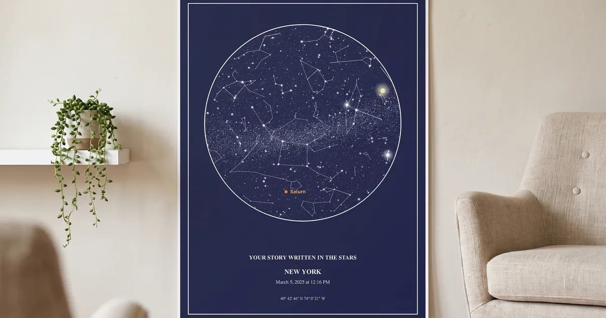
A computed one is. Ours places every star from the European Space Agency’s Hipparcos catalogue, corrects it for the slow wobble of Earth’s axis to your date, and turns it into the sky over your place at your minute. We check the result against astropy, the software professional astronomers use: the planets land within 0.15° for every date from 1900 to 2100, under a millimetre on a 24x36 print.
By Mayukh Bagchi, founder & phd candidate in astronomy · sources linked below
The method
How a real star map is computed
1 · The stars
Positions and brightness come from the Hipparcos catalogue, measured by an ESA satellite between 1989 and 1993. Our copy holds the 8,874 stars brighter than magnitude 6.5; the chart draws the 2,851 down to magnitude 5.5, about what the eye sees under a dark sky.
2 · Your date
Catalogue positions are fixed to the year 2000. Earth’s axis wobbles one full circle every 26,000 years, so each star is moved for precession to the date you choose.
3 · Your time and place
The time zone and its daylight-saving history are looked up from the coordinates, so 9 pm in Chicago in 1975 is the 9 pm Chicago’s clocks showed. From that instant we work out the local sidereal time, which tells us which part of the sky was overhead.
4 · The drawing
The sky is drawn in stereographic projection centred on the zenith: the point straight overhead is the middle, the rim is the horizon all the way round, and constellation shapes stay true. The planets and the Moon are computed for the same minute.
Measured, not promised
How close to the real sky it is
We compare the chart engine with astropy for thousands of instants between 1900 and 2100, and the check fails if any figure goes over its limit. For scale, 0.15° is under a millimetre at the horizon of a 24x36 poster.
- Star positions
- ESA Hipparcos catalogue, corrected for precession to your date
- Precession matches astropy to under 0.001°
- Planets
- Computed from their orbits for the exact minute
- Within 0.15° of astropy for every date 1900–2100
- Moon phase
- Sun–Moon angle at that minute
- Within 0.1°, about 12 minutes of the Moon’s motion
- Local time
- Time zone and daylight-saving history looked up from the place
- Historical time-zone and daylight-saving rules for that place
- Left out on purpose
- Nutation, aberration and the stars’ own motion
- Under 0.01° for 95 % of stars; 0.16° for the fastest
What we leave out, and why: nutation and aberration each shift the sky by under 0.006°. Stars also drift across the sky on their own, but slowly: over 1900–2100, 95 % of the stars on the chart move less than 0.01°. The fastest, 61 Cygni, moves 0.16° at the far ends of that range, about a millimetre on a 24x36 print. Atmospheric refraction, which lifts stars near the horizon by about half a degree, depends on that night’s weather, so like every printed star chart we show geometric positions.
Two minutes, free
How to check any star map
- 1. Change the city. Preview the same date for two places far apart, such as London and Sydney. A computed map changes completely; a decorative pattern doesn’t.
- 2. Compare with Stellarium. Open the free Stellarium web app, set the same place, date and time, and look straight up. The constellations in the middle of the chart should be the ones overhead.
- 3. Find a planet. Bright planets move from month to month. If the chart shows Jupiter, Stellarium should show it in the same constellation.
- 4. Ask for the catalogue. A seller computing real skies can name its star catalogue. Ours is Hipparcos.
Try it on ours: the free preview draws the real sky for any date and place before you pay anything, and the guide to reading a star chart shows what each part of it means.

Who checks it
Built by an astronomer
Mayukh Bagchi is an astronomy PhD candidate developing balloon-borne VLBI telescopes for black hole research. He oversees the chart engine and the astropy check described above. More about him.
If a star or planet on your chart looks wrong to you, write to us with the date, time and place and we will check it.
Questions
Star map accuracy: questions
- Are custom star maps accurate?
- A properly computed one is. Ours places each star from the ESA Hipparcos catalogue, corrects it for the slow wobble of Earth’s axis to your date, and turns it into your local sky using the exact time and place. The planets land within 0.15° of astropy, the software professional astronomers use, which is under a millimetre on a 24x36 print.
- Is a star map the real sky or an illustration?
- It should be the real sky, computed for one place and one minute. Some decorative prints use a generic star pattern that is the same for every order. A computed map changes when you change the date, time or city, and the constellations sit where an observer standing there would have seen them.
- Why does the time of day matter?
- The sky turns about 15° every hour as Earth rotates, so a chart for 9 pm and one for midnight on the same date show visibly different stars rising and setting. If you don’t know the time, choose a meaningful evening hour; the stars overhead will still be the ones of that night and season.
- How many stars are on the map?
- Every star down to magnitude 5.5, which is close to what the eye picks out under a dark country sky. That is 2,851 stars across the whole sky; about half are above the horizon at any moment, so a chart shows roughly that many. Fainter stars are left out because nobody could have seen them without binoculars.
- Can I check my star map myself?
- Yes. Open the free Stellarium web app, set the same place, date and time, and look straight up. The constellations near the middle of your chart should be the ones overhead in Stellarium, and the bright planets should match. Near the edge, remember that our chart shows the whole sky down to the horizon in every direction.
- Why don’t you correct for atmospheric refraction?
- Refraction lifts objects near the horizon by about half a degree, depending on the weather that night, which nobody can know for a past date. A star chart traditionally shows geometric positions, as ours does, so a star on the rim may have appeared slightly higher to someone standing there.
Sources: European Space Agency, the Hipparcos mission; astropy (ERFA) for the reference positions; Stellarium for checking a chart. Related: can you name a star? · star map sites compared
See it for yourself
Preview the real sky of any night, free
Digital $19.99. Framed from $79.99. Free Shipping on every print.